Our oldest son arrived for the weekend a few hours after I returned from the Bay Area. I opted for a nap and a Papa Murphy's pizza that night instead of a big home cooked meal... a great choice for everyone.
On Saturday we decided to drive up country to find some FALL COLOR. Oh my, did we find the beauty of Fall. It was everywhere.
We drove up highway 88 to Red Corral and took the Red Corral Rd. south, over the Mokelumne River, to West Point. We stopped at the Tiger Creek White Water take-out. A "take out" is where you take out your raft, kayak or canoe after you have gone down river in it.
This stretch of the Mokelumne River is the North Fork in Amador/ Calaveras County. It is 3 miles long and has been determined by American Whitewater to be a
class III-IV section.That means it is
difficult. You had better know how to "white water" raft or kayak before attempting to navigate this section of the river. But here at the "take out" it is beautiful and deep. Someone has even carved stairs in the bedrock. I don't know who did this but it wasn't easy. I don't know how the environmentalist can complain about small dredging operations ( and I do mean small and recreational.) when they deface the gorgeous bedrock by gouging steps into it for better access getting out of the water... but what do I know.
This, to me, is environmental damage that is done for convenience.
But I guess it serves their purpose, so it becomes
environmentally OK... but what do I know.
Look at this...
It's amazingly beautiful isn't it? It's like a painting.
A wonderful place to swim in summer... if you don't mind sharing the rocks with Rattlesnakes, who love to use these strongholds as refuge from the intense summer heat. Now the snakes have stairs to help them get down to the water.
We drove on to West Point, originally known as Indian Gulch. There was a camp established here by the scout Kit Carson. This is a very interesting little town... in the middle of nowhere.
Where a little old lady, pushing a wheel chair, has the right of way.
Where the old Main St is only a couple of blocks long and "the variety store" is in someone's house.
Where the general store is packed to the ceiling and has everything you could possibly need... if your "need" isn't too great.
We bought cold drinks.

And a bar where I'm sure that "everyone knows your name".
The population is about 670 folks spread out over many rural miles, but Census workers are warned to not enter some backwoods areas for fear of
both "meth" lab and/or marijuana growing operations
encroachments, so this number may not be accurate. It's very rural and has always had a reputation for individualism and a "don't mess with us." attitude. Churches abound
, so someone is trying to keep things under control.
I. personally, like the feel of the place. .. but I think you kind of have to earn your citizenship up there. It's a town of cautious friendliness.
We continued south to Rail Road Flat. This town does not have an designated
downtown. The town is registered as a California Historical Landmark.
This Landmark site says it all...
If I may reiterate, for those of you that don't have a big screen computer...
This historic mining town,with an elevations of 2,600 feet, was named after primitive mule-drawn ore cars used here. There was never actually a railroad here. The town was established in 1849. It was the site of an Indian council as well as the center of rich placer and quartz mining. Its largest producer was the Petticoat Mine. The Post Office was established in 1857, closed in 1858, and re-established in 1869
. The town's population was decimated in 1880 by Black Fever.
Across the street from the monument was a huge building.
No one was anywhere to be seen but there were a few honest to goodness BUFFALO out in the pasture behind the building.
Just enjoying the weather.
And munching the grass. There were no people around anywhere, so I'm guessing that the business of "trophy hunting" and Bison meat is out of business. Hope so. These Buffalo looked like some of our "Happy California Cows". They didn't even react when I whistled to get their attention. They just kept eatin' the grass.
They are awesome animals. Hard to believe there were huge herds of them roaming the plains of America once. You can read about them
HERE. This is everything you every wanted to know about the American Bison.
We continued on, enjoying the beautiful countryside with all the fall color and sky so blue that you could feel the colors inside of you.
The road that we turned on, to head west, was called Jesus Maria and it was a very narrow road, with trees arcing over us as we drove. The sun was sparkling through the trees and casting shadows on everything. The trees hung over us and the road became smaller and smaller.
Eventually we reached an old mining town with the same name, Jesus Maria. Just a wide open area with a farm and an old barn.
Jesus Maria is an unincorporated area
in Calaveras County. It lies at an elevation of 1043 feet
It use to be the center of a large placer mining section, named for a Mexican who raised vegetables and melons
for the miners. It was settled in the early 1850s with a large population of Mexicans, French, Chileans, and Italians. Now it is only populated by a few families who live together and work for common goals, including a large community garden, basketball court, a jungle gym for children, and a windmill to pump water. Jesus Maria is registered as a California Historical Landmark.
It's a beautiful, open valley with lots of huge bedrock laced with gold bearing quartz. and a stream that looks like it runs all year long. The bedrock is amazing.
With lots of quarts running through it.
I just can't get enough of this kind of rock.
Where is my pick and my gold pan. Look at all those crevices.
This all use to be at the bottom of a river.
I wanted to stop and dig in the creek across the road.
The urge to stop, get out and dig was intense... to scrape in between those wonderful rocks ,were all the years of debris have accumulated. Gold fever... it's in my heart and soul. It's a driving force.. a ...
But, we didn't stop.
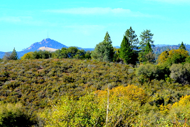
We drove on, until we saw Butte Mountain in the distance and finally knew where we were... sort of.
We knew we were going in the right direction, but the road was getting smaller and we had never been over this road before. We laughed at the idea that the road might just end in the dirt somewhere and that we would have to go back the way we came. But it didn't.
We came to highway 26 and we knew that Mokelumne Hill was right down the road.
We took a quick detour down through the town of Moke Hill to show our son, who hadn't been there before. Its charm, as always, is evident.
This is another historic site.
Please
read the history part of Wikipedia's info on this interesting town. It wasn't always a small town.
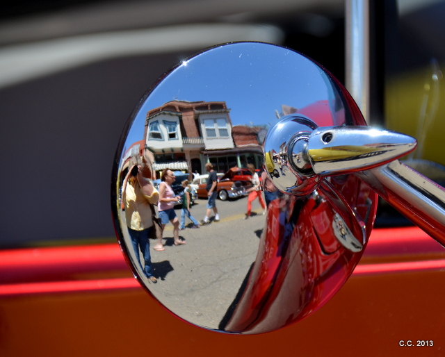
I took this photo of a building in the downtown area of Moke Hill.
Then I noticed that the OPEN sign was made on a piece of screen with little Christmas lights and it was reflecting on the wall behind it up on the second story balcony.
I wish I could have been a little higher so the reflection of the word "open " would have been complete. I think it's an interesting shot. Always look for shot within the shot. Find the most interesting part of a photo and don't be afraid to crop your photo to get that shot.
Oh look... I found the "open" word in another photo. I cropped it and well... what do you think?
Isn't this fun? Yea, well, we all have our obsessions. This photography stuff is mine.
I'm still tired from the activities of last week, so I'm going to stop tonight.
Don't forget to vote tomorrow. We can all look forward to not seeing all those political ads on TV anymore. That should be incentive enough.